DroneDev equips commercial drone platforms with combat-grade autonomous capabilities — all running on a phone, fully offline. Every feature below, from neural network-based computer vision to sensor-fused dead reckoning, has been tested on real hardware with INAV and ArduPilot flight controllers.
Navigation#
Dead Reckoning#
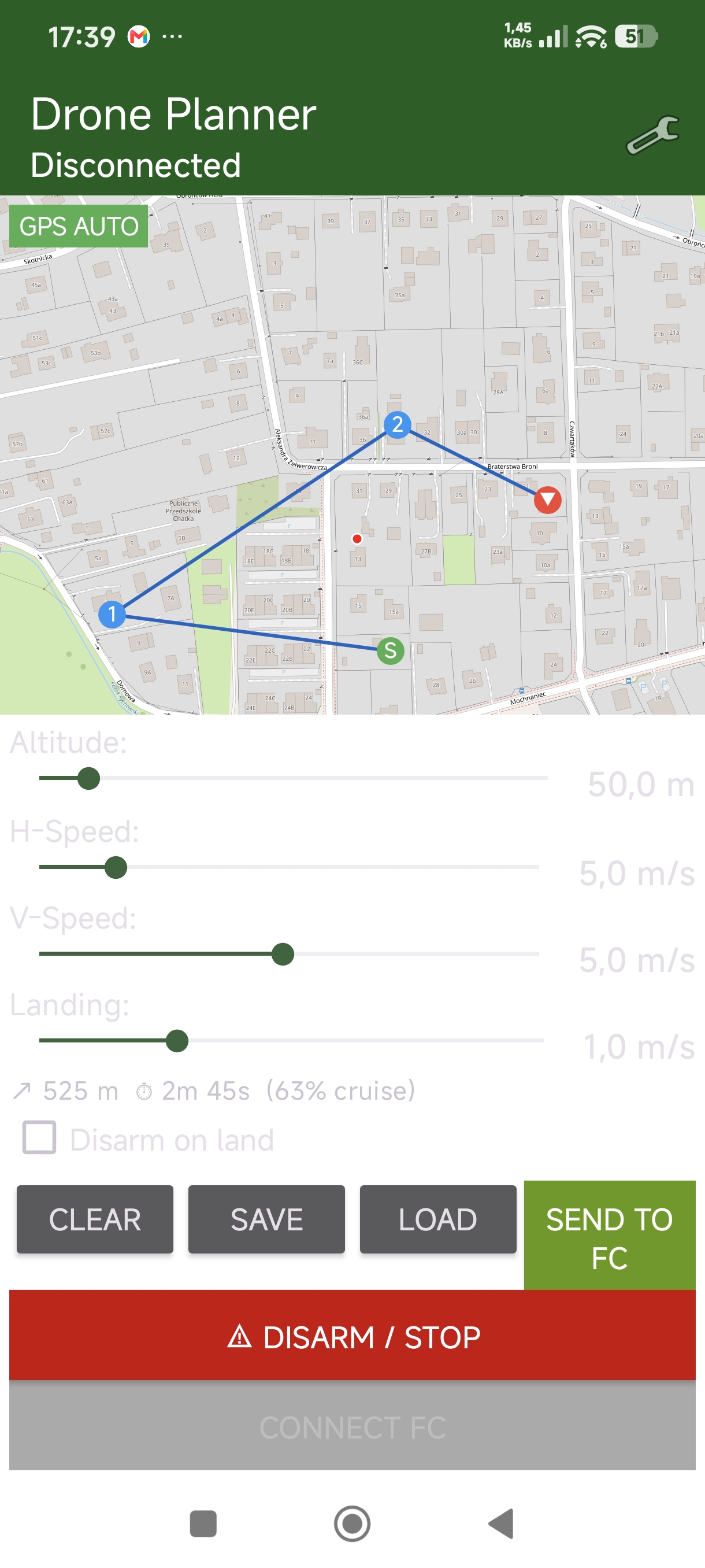
When GPS falls — through jamming, spoofing, or terrain masking — DroneDev maintains position using phone camera, AI vision, and IMU sensor fusion at high frequency. An advanced sensor fusion engine combines camera-based positioning with compass, gyroscope, and accelerometer data to deliver continuous navigation through denied environments.
- GPS Monitoring — Continuous health polling with automatic fallback trigger
- Heading Estimation — Fused compass + gyro for reliable orientation when magnetometer is compromised
- Altitude Compensation — Altitude maintained via flight controller telemetry
Visual Homing — Neural Network Wind-Drift Compensation#
When crosswinds push the drone off-course, DroneDev’s deep convolutional neural network (YOLOv8s) automatically detects and locks onto a landmark on the horizon — buildings, towers, trees — and uses it to maintain course. The system compensates for crosswind drift in real time, keeping the drone on target without GPS.
- Neural network selects and tracks landmarks automatically — no manual tagging required
- Real-time heading correction compensates for crosswind drift
- Works in real time on the phone’s NPU — completely offline, no cloud dependency
Search Patterns#
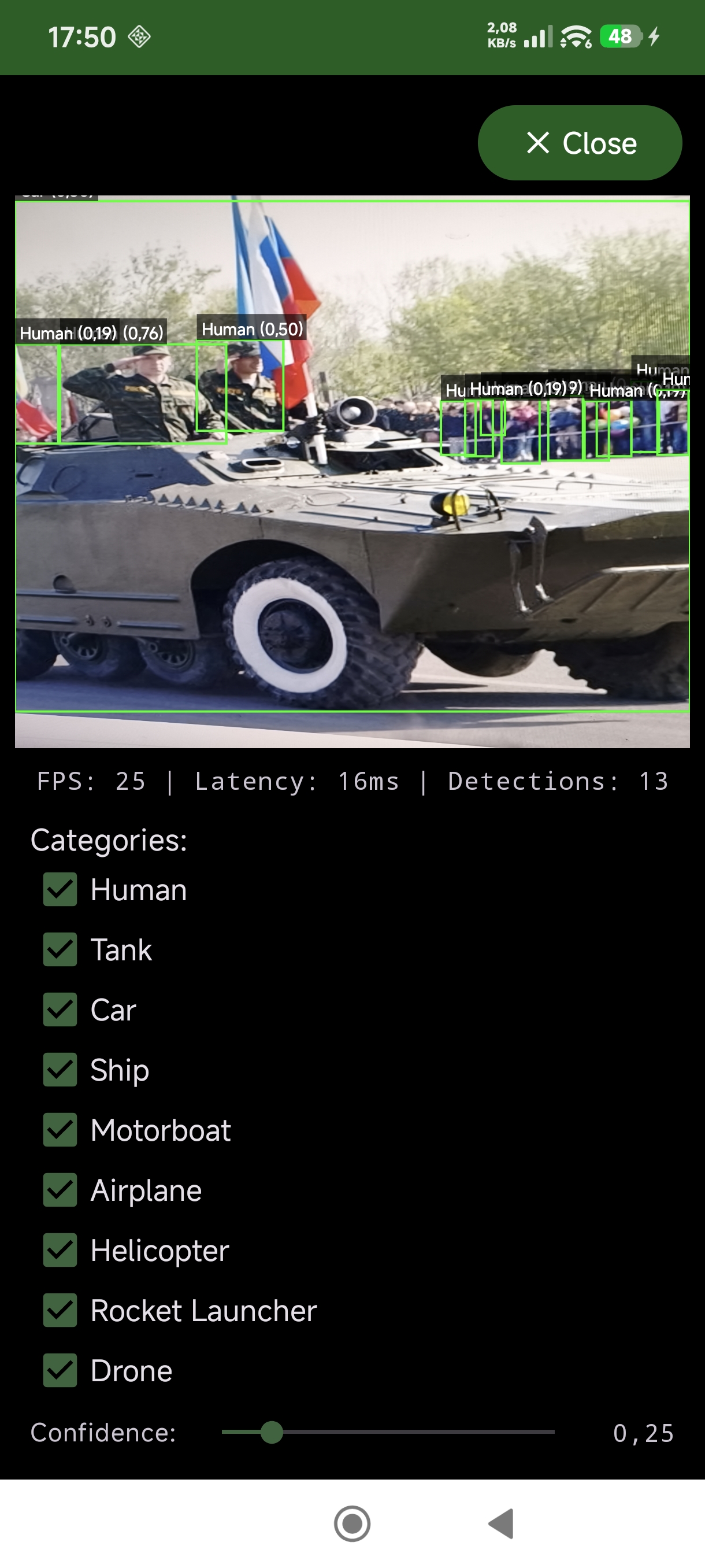
Autonomous search pattern generation for area coverage missions. Four pattern types optimized for different operational needs:
- Grid — Systematic coverage for known-area search
- Spiral — Expanding coverage from a point of interest
- Creeping Line — Linear search along corridors or borders
- Expanding Square — Perimeter security and containment
Patterns execute autonomously with configurable spacing, altitude, and speed parameters.
Computer Vision — AI & Neural Networks#
Object Detection#
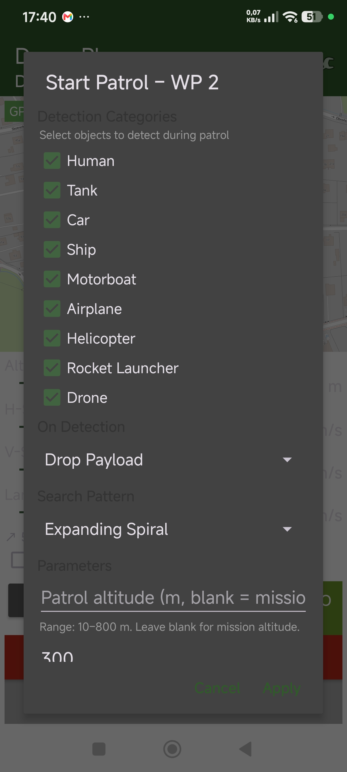
YOLOv8s — a deep convolutional neural network — running on-device via TFLite with hardware acceleration on the phone’s dedicated NPU. Detection categories are defined by your training data — customize for personnel, vehicles, structures, or any target class. The neural network performs inference with configurable confidence thresholds.
- Neural network inference on-device — No cloud round-trip latency, no connectivity required
- Persistent tracking — Intelligent matching maintains object identity across frames
- World-coordinate mapping — Pixel detections transformed to real-world coordinates via on-device positioning
- EXIF geotagging — Every capture tagged with coordinates, category, and confidence score
Visual-Inertial Odometry#
High-speed VIO pipeline for continuous pose estimation. Provides the spatial foundation for detection mapping, dead reckoning correction, and visual homing — all without external references.
Autonomy & Patrol#
Autonomous Missions#
Fully autonomous search-and-detect patrols. Configure a search pattern, define detection responses, and launch. The drone executes independently:
- Photo Capture — Document detected objects with geotagged imagery
- Precision Landing — Land at detection coordinates
- Payload Drop — Deploy payload on positive identification
- Track & Follow — Maintain visual lock on moving targets
- Return to Home — Visual homing or dead-reckoned RTH
Sensor Fusion Engine#
Multi-provider architecture aggregates all phone sensors into a unified state estimate:
- IMU — Gyroscope + accelerometer at high frequency
- Compass — Magnetometer with hard/soft iron calibration
- Camera + AI — Visual-inertial odometry and neural network detection
- GPS — When available, fused with dead reckoning for enhanced accuracy
Compatibility#
Protocol Auto-Detection#
Connect any supported flight controller via USB-OTG. DroneDev probes MSP v2 first, then falls back to MAVLink v2 — no manual configuration required. RC channel override works identically across both protocols via a unified control system.
Supported Flight Controllers#
| Protocol | Version | Baud Rate | Target Firmware |
|---|---|---|---|
| MSP v2 | Full command set | Standard | INAV 7+, Betaflight |
| MAVLink v2 | GUIDED mode | Standard | ArduPilot 4.x+ |
Tested Hardware: Modern Android phone → INAV/ArduPilot flight controller via USB-OTG cable.
Zero Connectivity Required#
Every capability runs entirely on the phone. No cloud API calls. No internet dependency. No data exfiltration. DroneDev is designed for operations where connectivity is either unavailable or unacceptable — and that design constraint is treated as a feature, not a limitation.
See the Full Capability Set
Schedule a technical deep-dive with our engineering team. See dead reckoning, AI detection, and visual homing demonstrated on real hardware.
Request Technical Briefing →